

Sunday, February 15, 2009
Takht e soleiman
--------------------------------------------------------------------------------
Takht e soleiman
The aggregate of the Takht-e-Soleiman monument is placed on a natural high land, about 20 m. above the surrounding plain. All the structural relics have been constructed within an oval shaped rampart. The exterior rampart with 5 m. thickness, 14 m. height and outer circumference of 1,200 m. has 38 conical defense towers.
The outer wall is a remnant from the Sassanian period. During the Ilkhanan reign, a new gateway had been constructed adjoined with the former southern gateway. Within the oval rampart there are two square plots, with uniaxis and different centers.
In the centers of the southern square there is a lake and the northern square an ancient fire-temple respectively. Eivan-e-Khosrow is placed to the north western direction of the lake and to its southern side is Eivan-e-Garabaq-e-Khosrow. Takht-e-Soleiman was destroyed during the Roman conquest in 624 AD.
In archeological surveys around the area of the fire-temple a variety of coins, tiles and a huge copper cooking vessel (a remnant of the Islamic period), have been discovered. The Soleiman prison which consists of the remnants of a pre-historic and the Medes temple is included in this aggregate. Sites such as dormant volcanoes, thermal springs and streams around Takht-e-Soleiman are worth surveying.
Azargoshnasb Fire Temple 45 kilometers northeast of the city of Takab, a historic site can be seen. It is the heritage remained from the Sassanid era (226–650 AD). Takht-e Soleiman (Solomon’s Throne) is home to one of the three famous Sassanid fire temples. It is also where the kings of the Sassanid dynasty were crowned. This monument was most probably built during the reign of King Pirooz (457- 484 AD), King Anoushirvan’s grandfather.
Although archeological excavations in the historic site of Takht-e Soleiman have also revealed remains of the Achaemenid and Median eras, this ancient site is most known for its Sassanid monuments such as:
Azargoshnasb Fire Temple,
Anahita Temple,
Hadaya (Gifts) Museum,
Zendan (Jail) Mountain,
and Belgheis Castle.
Remains of the only castle dating back to the Ilkhanid period (1256-1353 AD) can also be seen in this historic site. In addition to historic monuments, those who travel to Takht-e Soleiman may also see an absolutely eye-catching lake with changing colors in front of Khosrow’s portico. The deepest point of this lake is 112 meters from the sea level. Its temperature is reduced to 40 degree Celsius due to a natural spring that exists along its bed.
The complex of Takht-e Soleiman and its landscape is the first Persian heritage inscribed in UNESCO’s List of World Heritage Sites after the Islamic revolution of 1979.
With over 2,000 years of history, the magnificent archaeological treasures of Takht-e Soleiman signifies cultural heritage of ancient Iranian civilization.
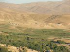
Takht-e Soleiman and its archaeological artifacts, as one of the most notable and celebrated centers for Iranian civilization, has put behind its glorious days of prosperity, and is now lying in peace, quite in the outskirts of Afshar’s mountains, 45 kilometers. northeast of Takab, West Azarbaijan.
The historical region is only reachable through Zanjan-Bijar or Miandoab-Shahindej road toward Qara Bolagh, northeast of Takht-e Soleiman. The historical monument has never been put researched thoroughly by Iranian archaeologists and foreign experts - perhaps because of the long distance.
Takht-e Soleiman used to be a magnificent castle for ancient Iranian preachers called “Mogh” who used to reign during the Ashkanid and Sassanid eras. The historical monument was ruined after suffering from constant attacks by the Roman, Arab and Mongol invaders.
Takht-e-Soleiman castel
The castle has been constructed around a lake surrounded by stone hedges. In an oval shape it is stretched about 400 meters to the south and 200 meters to the west. The magnificent stronghold consists of a collection of swimming pool and lake, a place of worship, entrance gates, tall columns, hall, place of swearing, fire temples, mineral hot spring, and watch towers. With its purple and blue color, the pool, known as Takht-e Soleiman Lake, is one of the wonders of this historical site. It is about 80 meters wide and 120 meters long. With a depth of 110 meters it flows like a hot spring, pumping out about 100 liters of water every second. From the southern part, the castle looks like a gate with ruined walls - the 3-roofless rooms that used to be a place of worship for ancient Iranians.
Historians believe that the Mongol ruler, Abaqa Khan, Jenghiz Khan’s grandson, converted to Islam after invading Iran and built a mosque on top of the castle, which was ruined in later times. The 7-meter column at the entrance used to be the hall of Khosro Parviz which now has only one column left. About 20 years ago scaffolding was set up around the column to stop it from more damage and possible collapse. Sign of ancient repair jobs are clearly visible on many parts of the column. Known as “Madayen Hall”, the hall used to be a palace for many Iranian monarchs. Series of steps have remained at a memorial site in the northern part of the castle that used to be a place for giving oath.
Diverse Islamic tile-works decorating the walls are so much in place that can be classified into many different architectural schools, the important of which are golden stone tablets, engraved tile-works with blue backgrounds, and gold-plated pictures of mythical animals such as phoenix and dragon. Known as Azar Goshasb and Anahita, the private and public fire temples also narrate their own unique fable. In the book “A Glance at Azarbaijan” written by Muhammad Javad, it is said that Javidan Fire Temple used to burn forever because it was built on top of an oil well - hence the name Javidan (never-ending).
The castle used to be the capital of Azarbaijan in the Sassanid era. The main fire temple had four columns and one dome with crescent ceilings and plaster works. People used to pray in the temple for solving their problems. Anahita Fire Temple which has now only eight columns left, was brought up to the surface by a group of archaeologists from Iran and Germany.
Soleiman Prison,
Soleiman Prison, 5 km from the castle, has architectural works in stone and clay that date back to the first millennium B.C. Legend has it that the place used to be a prison for locking up demons on a mountain top during the days of Prophet Soleiman. There used to be an inactive volcano on its top as well. The terrible prison was about 100 meters high and used to discharge an unpleasant smell of gas.
Anahita Temple
Takht-e Soleiman has two entrance-gates from the south and the north. An archaeological team has been dispatched for the restoration of the ancient palace by West Azarbaijan Cultural Heritage Department.
Currently, the team is focusing on the restoration of the monument , as well as documentation of its artifacts, earthenware, and tile-works. Most of these recovered treasures will be on display at museums in the near future. Over 1,200 artifacts have been discovered from Takht-e Soleiman that have a great historical value for the country.
Lack of regular transportation as well as accommodation facilities are among the major problems for many tourists visiting the ancient complex. Local tourists likewise complain about their little knowledge on the site because of improper advertising methods. This is despite the fact that foreign tourists have more information about the place than their local counterparts.
The governor-general of Takab is convinced that the archaeological and historical treasures in the region should be a good incentive for attracting public and private investments on the industry of tourism in this particular region.
With a population of 85,000 inhabitants, Takab is located in the east-west of ‘West Azarbaijan Provin
Monday, April 28, 2008
Takht-e Suleiman
 ">" border="0" alt="" />
Sacred lake of Takht-e Suleiman
(Order Fine Art Print)
Located in a mountainous area of northwestern Iran and 42 kilometers north of the village of Takab, Takht-e Suleiman (the ‘Throne of Solomon’) is one of the most interesting and enigmatic sacred sites in Iran. Its setting and landforms must certainly have inspired the mythic imagination of the archaic mind. Situated in a small valley, at the center of a flat stone hill rising twenty meters above the surrounding lands, is a small lake of mysterious beauty. Brilliantly clear but dark as night due to its depth, the lake’s waters are fed by a hidden spring far below the surface. Places like this were known in legendary times as portals to the underworld, as abodes of the earth spirits.
Archaeological studies have shown that human settlements existed in the immediate region since at least the 1st millennium BC, with the earliest building remains upon the lake-mound from the Achaemenian culture (559-330 BC). During this period the fire temple of Adur Gushasp (Azargoshnasb) was first constructed and it became one of the greatest religious sanctuaries of Zoroastrianism, functioning through three dynasties (Achaemenian, Parthian, Sassanian) for nearly a thousand years. In the early Sassanian period of the 3rd century AD, the entire plateau was fortified with a massive wall and 38 towers. In later Sassanian times, particularly during the reigns of Khosrow-Anushirvan (531-579 AD) and Khosrow II (590-628), extensive temple facilities were erected on the northern side of the lake to accommodate the large numbers of pilgrims coming to the shrine from beyond the borders of Persia. Following the defeat of Khosrow II’s army by the Romans in 624 AD, the temple was destroyed and its importance as a pilgrimage destination rapidly declined. During the Mongol period (1220-1380), a series of small buildings were erected, mostly on the southern and western sides of the lake, and these seem to have been used for administrative and political rather than religious functions. The site was abandoned in the 17th century, for unknown reasons, and has been partially excavated by German and Iranian archaeologists in the past 100 years.
Tuesday, January 29, 2008
Sassanids Used Commercial Labels: Iranian Archeologists

The latest excavations at the northern gate of the Takht-e Suleiman historical site show that during the reign of the Sassanid dynasty (224-642 A.D.), Iranians used special labels on goods as a way of promoting their brands.
Since late July archeologists have been conducting concerted excavations in the site northwest of Iran. ?These labels served different functions. On one of them, you could see two abstract figures from the Sassanid court, indicating the goods were dedicated to the royal family,? said Yussef Moradi, head of the excavation team.
The labels are in the form of two seals engraved on earthenware vessels and are discovered on the top layer of soil near the northern gate. Archeologists hope to unravel bureaucratic relations of the era.
Located in a mountainous area of northwestern Iran and 42 kilometers north of Takab, Takht-e Suleiman (the ?Throne of Solomon?) is one of the most interesting and enigmatic sacred sites in Iran. Its setting and landforms must certainly have inspired the mythic imagination of the archaic mind. Situated in a small valley, at the center of a flat stone hill rising twenty meters above the surrounding lands, is a small lake of mysterious beauty. Brilliantly clear but dark as night due to its depth, the lake?s waters are fed by a hidden spring far below the surface. Places like this were known in legendary times as portals to the underworld, as abodes of the earth spirits.
Archaeological studies have shown that human settlements existed in the immediate region since at least the 1st millennium BC, with the earliest building remains upon the lake-mound from the Achaemenid culture (559-330 BC).
During this period the fire temple of Adur Gushasp (Azargoshnasb) was first constructed and it became one of the greatest religious sanctuaries of Zoroastrianism, functioning through three dynasties (Achaemenid, Parthian, Sassanid) for nearly a thousand years. In the early Sassanid period of the 3rd century AD, the entire plateau was fortified with a massive wall and 38 towers. In later Sassanid times, particularly during the reigns of Khosrow-Anushirvan (531-579 AD) and Khosrow II (590-628), extensive temple facilities were erected on the northern side of the lake to accommodate the large numbers of pilgrims coming to the shrine from beyond the borders of Persia. Following the defeat of Khosrow II?s army by the Romans in 624 AD, the temple was destroyed and its importance as a pilgrimage destination rapidly declined.
During the Mongol period (1220-1380), a series of small buildings were erected, mostly on the southern and western sides of the lake, and these seem to have been used for administrative and political rather than religious functions। The site was abandoned in the 17th century, for unknown reasons, and has been partially excavated by German and Iranian archaeologists in the past 100 years.
payvand
Wednesday, January 23, 2008
Takht-e Soleyman
Takht-e Soleymân is an outstanding archeological site with substantial Sasanian and Il-khanid ruins in Azarbaijan province, between Bijâr and Šâhin-dež, about 30 km north-northeast of Takâb, with about 2, 200 m altitude, surrounded by mountain chains of more than 3000 m altitude.
The place was obviously chosen for its natural peculiarity; an outcrop of limestone, about 60 m above the valley, built up by the sediments of the overflowing calcinating water of a thermal spring-lake (21° C) with about 80 m diameter and more than 60 m depth on the top of the hill (Damm).
The place is mentioned in most of the medieval Oriental chronicles (e.g., Ebn Khordâdbeh, pp. 19, 119 ff.; Tabari, p. 866; Nöldeke, p. 100, n. 1; Bel'ami, p. 942, tr., II, p. 292; Ebn al-Faqih, pp. 246, 286; Mas'udi, ed. Pellat, sec. 1400, tr., IV, pp. 74 f; idem, Tanbih, p. 95; Abu Dolaf, pp. 31 ff.; Ferdowsi, pp. 111 ff.; Yâqut, Beirut, III, pp. 383-84, tr., pp. 367 ff; Qazvini, II, pp. 267; Hamd-Allâh Mostawfi, p. 64, tr., p. 69, who attributes its foundation to the Kayanid Kay Khosrow) and was visited and described repeatedly by western travelers and scholars since the 19th century (e.g., Ker Porter, pp. 557 ff.; Monteith, pp. 7 ff.; Rawlinson, pp. 46 ff.; Houtum Schindler, pp. 327 f.; Jackson, 1906, pp. 124 ff.). It was erroneously taken for a second Ecbatana (q.v.) by Henry Rawlinson, and defective Byzantine sources caused it to be confused with the great Atropatenian city of Ganzak (q.v.) and other places (Minorsky).
A first archeological survey was carried out by the American Institute of Iranian Art and Archaeology under Arthur Upham Pope in 1937. Between 1959 and 1978 archeological excavations were conducted by the German Archealogical Institute together with the Iranian Antiquity Sevices (Edâra-ye koll-e háefâzáat-e âthâr-e bâstâni wa banâhâ-ye târikhi), which, during the first three seasons, has been working with Swedish cooperation. At present restoration and research are done by the Iranian Archeological Research Center (Pažuhešgâh-e bâstân-šenâsi).
The mention of the thermal lake in the Middle Persian Zoroastrian literature (Humbach), the medieval literary tradition, as well as the inscriptions on clay bullae found during the excavations (Göbl), provide grounds for identifying the site as the sanctuary of Âdur Gušnasp (q.v.), the fire of the warriors and kings and one of the three most revered fires of the Sasanian period (Boyce, pp. 8 ff.). Up to the early Islamic time the geographical name of the place and the region was Šiz, probably derived from the name of the Lake Chê chast (q.v.), which also seems to apply to Lake Urmia. In the Il-khanid period its name was Soqurluq/Sugurluq or Saturiq (Rašid-al-Din Fazµl-Allâh, ed. Jahn, pp. 70, 86; ed. 'Alizâda, pp. 200, 205; Hamd-Allâh Mostawfi, p. 64). The name Takht-e Solaymân (lit. Throne of Salomon), together with the surrounding mythological ensemble of Zendân-e Solaymân (Prison of Salomon), about 3 km west of Takht-e Solaymân, and Tawila-ye Solaymân (Stable of Salomon), and Takht-e Belqis (the throne of the queen of Sheba) appeared only after the Timurid conquest of Persia (still referred to as Soqurloq in 810/1407; Hâfezá-e Abru, I, p. 222)
The earliest settlement on the hill was a rather small and poor agglomeration of houses with stone socles and clay or mud brick walls at about 60 m northwest of the lake (Naumann and Huff, 1975, pp. 138 ff.). It is dated into the Achaemenid period by pottery and few small finds, like three-winged bronze arrowheads, beads of semiprecious stone and an elbow-shaped fibula. Intramural burials were placed in the corners and next to the walls of the houses and courtyards in pits cut into the rocky ground and partly covered by benches or walls. There were also dog burials. Earth burials are unexpected here in ancient Media, where, according to Herodotus (1.140), exposure of the dead was practiced. Traces of canals show that the water of the spring-lake was lead off for agricultural irrigation. Abandoned after a few generations, the clay buildings were washed down by the unregulated water that covered the site with a layer of limestone sediment.
During the Parthian period a small fortification was built at the northern edge of the lake. A rough-stone socle of a semicircular bastion and two branching off curtain walls were excavated under the great ayvân of the later temple. The scanty and seriously disturbed archeological layers delivered only some fragments of cinnamon ware for the Parthian dating. (Naumann, Huff, and Schnyder, 1975, p. 184)
The history of monumental architecture on the site began with mud brick buildings and foundations of rough-stone, laid out on a master plan, which determined all later building activities. Traces of this mud brick period, which itself had several phases, could only be uncovered in limited areas and sondages within the later massive stone and brick structures (Naumann and Huff, 1975, pp. 142 f.). The summit of the hill was surrounded by a mud brick wall, 12 m thick, with semicircular bastions. A northern gate and its semicircular gate towers were of baked bricks; we may presume the same for an early southern gate. In the more spacious area between the northern gate and the lake, a square area was enclosed by an inner mud brick wall, open to the lake side and with a northern inner gate of baked bricks in line with the outer northern gate (fig. 1). Here we have to presume the main buildings, which, however, were mostly destroyed by the massive stone and brick constructions of the later rebuilding. Traces of a large edifice with rooms along a rectangular hall or courtyard and an axial square room with four round columns of baked brick, accompanied by rectangular side rooms and an antechamber were unearthed in the western part of the square area. A regular layout of mud brick rooms was also found in the northeastern part of the square. A kiln for the production of bull's eye glass was installed there probably during the period of reconstruction into stone buildings. There is no evidence for which windows the glass roundels were employed. Some coins of Sasanian emperor Peroz (r. 457-84) and a newly coined gold dinar of the Byzantine emperor Theodosius II (r. 408-50) give an approximate date for the mud brick period. (Naumann, Huff, and Schnyder, 1975, p. 164-68) There is no archeological evidence of the function of the mud brick buildings, but with regard of the undoubtedly religious nature of the later fire sanctuary we may justly presume the same function for the predecessor.
The replacement of the mud brick architecture by masonry constructions of stone and baked brick was a gradual process with periods of coexistence of mud brick and stone buildings side by side. According to find coins from the last years of reigns of Sasanian Kavâd I (since 528) and his successor Khosrow I Anoširavân (531-79) in the layers above razed parts of the mud brick buildings, we may hypothetically presume that the process of architectural transformation began after the suppression of the Mazdakite movement about 528 C.E. and with the reestablishment of the Zoroastrian state church, which was carried out by Khosrow I, who was the crown prince at that time.
The main parts of the sanctuary, the first to be replaced, are distinguished by cut blocks of stone and well-baked bricks; later periods used rough stone. The exterior mud brick wall was coated by a rough-stone wall with a facing of large stone slabs, imitating stretching and heading bond, obviously a copy of the technically more perfect masonry of the great Caucasian wall of Darband (see FORTIFICATIONS), which is ascribed to the reign of Khosrow I Anoširavân. The northern stone gate, built exactly on the place of the older one and badly damaged now, was obviously identical with the well-preserved southern gate with its gallery of blind windows above and its lateral semicircular bastions (Osten and Naumann, pp. 39 ff). The lower part of the gate is covered with debris, only the upper part, that is less than half of the gate height, being visible today. The wall had an uncovered passage with parapet and stepped crenellations, tower chambers above the massive bastions, and connecting vertical shafts down to the gate-house, probably for interlucation. The inner brick wall was replaced by a stone wall with interior vaulted corridor and semicircular bastions outside. The old inner gate of baked brick was kept in use unchanged.
Traces of rough-stone foundations in a sounding west of the lake suggest that another mud brick wall with inner corridor and bastions enclosed the lake and the southern part of the precinct as a second square, in line with the northern area. This wall however was never replaced by a stone structure, and so probably were kept all other buildings in this southern area, with the result that the clay material was dug away and reused by post-Sasanian occupation and the remains were washed off by the water, which in the end covered all the area with a thick sediment of limestone, making excavation nearly impossible here. The architectural layout inside the oval exterior wall may be reconstructed as a walled in rectangle, long twice its width, fortified by semicircular bastions and with a high and bulky building protruding from the center of its impressive western front of 280 m length. This building was a palace (fig. 1) with rooms of different size surrounding an ayvân, the biggest construction of the site. The three rooms at its western front have wide openings to the outside, perhaps for ceremonial purposes. The ayvân was open to the area north of the lake, obviously a royal courtyard. The western, eastern, and southern banks of the lake probably served as a forecourt with the lake as a natural pool in the center. There should have been an inner southern gate, continuing the access from the outer southern gate, but this could not be verified.
The square enclosure on the north side of the royal court was the temple area proper, accessible from the north gate as well as from the royal courtyard in the south, where its facade consisted of two wings of arcades on either side of the big temple ayvân. The northern enclosure is divided into two unequal parts by a straight corridor, connecting the royal court with the northern temple court. The main building in the larger part is a massive chahârtÂâq (q.v.) with surrounding corridors, located exactly on the main north-south axis of the layout. In its central, domed cella (A), the gonbad (see DOME), we have to presume the place of the Âdur Gušnasp fire altar, now destroyed by treasure hunters who have hacked open the brick floor, which originally was paved with yellow travertine (fig. 1). Traces of podiums, socles, and stands or poles surrounding the center indicate that it is the place of the altar (Naumann and Huff, 1965-66, pp. 622 ff.). The cella was shielded from the corridors by thin walls or parapets. There were gates from outside in line with the main axis, but broken off thin brickwork seems to be the remains of some kind of closure of contraction of the opening. Narrow-sided doors lead into the eastern corridor from north and south. There is no sufficient evidence to explain in detail how the interior of the temple was used by priests and devotees. However, the superficial impression of openness given by the axis, which ran through the temple uninterruptedly from the outer north gate to the center of the lake is misleading. In fact there were two opposite ways of approach from north and south, each ending up in an ayvân in front of the central temple building (Huff, forthcoming). The southern approach from the royal courtyard, doubtlessly was reserved for the king and his court. A special link between the temple and the royal palace is a podium of perfectly polished blocks of freestone with a small stair, standing on the axis of the palace ayvân but immediately in front of the temple ayvân. This probably carried an open-air throne.
The northern approach, certainly the access for the normal pilgrims, is a diminished repetition of the southern royal one. The northern ayvân (I), closed by a front wall with a door for climatic reasons during a later period, and the door into the temple were considerably smaller at the north side. The arcades, starting from the northern ayvân with an identical design as in the south, enclose a comparatively small northern forecourt. The pilgrims, after scrambling up the high northern slope of the hill, had to continue climbing on from the outer north gate through the inner northern gate up to the gatehouse of the northern forecourt, a painstaking access, compared with the comfortable southern approach for the king through the higher situated outer southern gate (fig. 1). Traces of simple mud brick structures on the west side of the second northern forecourt were obviously the remains of shelters, hostels and toilets for the pilgrims, taking the place of the royal palace in the south. Especially here some small amulets or votive plaques of gold, silver and bronze were found, with anthropomorphous or symbolic representations. A specific civilian function must be attributed to a room (Z) between the gate house of the northern temple court (M) and the entrance to the north-south corridor; a hoard find of clay sealings of documents, so-called bullae (Göbl; Huff, 1987), indicates that this was a room for scribes and an office and archive for acts of civil administration, duties of which the Sasanian clergy was in charge. The location at a "high gate," at the entrance to an official area, is typical for places of this kind.
The very specific layout of the eastern rooms of the great temple got varying interpretations, which are difficult to verify. An inner courtyard (E) with arcades and a windmill-like arrangement of surrounding rooms may have been a depot or treasury. Of special interest is a cruciform room with a central dome (fig. 1), another closed ch, the only one with a direct, axial connection with the gonbad. In its center a basin, 3 m2, was set up on the brick floor by side walls, 33 cm high (Osten and Naumann, pp. 57 ff). The room was alternatively interpreted as a room for permanently sheltering the sacred fire (atašgâh), from which the fire was carried into the great gonbad for official ceremonies, a theory developed by Kurt Erdmann (1941, pp. 48-65), which meanwhile has proven obsolete, as a room for ritual washing, as an Anâhitâ water temple (see ANÂHÈD), which also must be excluded, because a wide opening on the south side of the basin could not be tightly closed to keep the water. As quantities of fine grayish material were found in the basin, which might have been ashes, it seems possible, that the ashes of the sacred fire was collected and stored here, to be distributed to the faithful, a tradition which still exists in contemporary fire temples (communication with members of Yazd Zoroastrian community).
The western part of the sacred enclosure, which was separated from the main sanctuary by the north-south corridor, was identified as a completely independent, second fire temple, with subsidiary buildings of its own. The temple proper consisted of a straight sequence of two three-winged columnar halls (PLATE I; fig. 1), the first with rectangular, the second with round pillars of stone and baked bricks respectively, of anterooms and of a cruciform, domed cella (fig. 1), where the lower part of a fire altar was preserved (Naumann and Huff, 1975, pp. 147 ff.). Before the rebuilding of the sanctuary the fire burned in the square mud brick room with four columns, which was found beneath the later anteroom, and this older brick cella was even preserved as an anteroom when the cruciform stone cellar was built and the fire transferred there; it was replaced by the stone anterooms only during a later reconstruction.
The two columnar halls of the stone temple were separated by a thin brick wall with narrow gates in the side wings only, and in the second hall too the direct access to the altar room originally was blocked by a thin brick wall, so that there was no possibility to view or walk along up to the fire altar. The second hall had benches or platforms in between both tiers of columns with niches on either side, in which several round, conical gypsum objects were placed, broken off at the top, perhaps supports or stands for ritual purposes. Beside several of the columns, the lower parts of roughly worked, rounded shafts of lime stone with cubical base and a decorative ring at mid height were preserved, fragments of which had been found in several places on the site. As they resemble the shafts of fire altars on Sasanian coins, they are generally interpreted is such. This is doubtful, however, because of their small size. They may be supports for incense burners, as depicted on the Issakvand and near Kermân (Huff, 1999, pp. 23-27) tomb relief, or of some other liturgical requisite. The altar of a sacred fire was considerably bigger and more steadfast, as demonstrated by the remainders in the altar room of the second temple. The altar there, walled up of brick, stone, and mortar, had a shaft of 65 cm diameter; the three-stepped socle was 1.63 m2, and the altar table must have had about 1 m side length (Plate II).
Fragments of anthropomorphous, theriomorphous and floral plaster reliefs as well as column flutings, deliberately buried and preserved in the clay fill of a secondary floor, demonstrate that especially the altar room and the halls of the second temple, but in analogy also the great main temple and the palace, were richly decorated with stucco. They also indicate a severe destruction of the buildings and a period of obviously less luxurious restoration. This might be connected with the devastation of the site during the Persian campaign of the Byzantine emperor Heraclius 624-28 C.E., who described the demolition of the idols in the heathenish temple in his report to the senate of Constantinople (Minorsky, pp. 91 ff.; Sebeos, tr., I, pp. 80 f. II, pp. 214 ff).
The western part of the second temple (fig. 1) obviously served for more profane purposes. However, a sequence of two rooms immediately beside the anteroom and the altar room show a special relationship to the sacred area. With view blocked by shifted doors and a very small side cabinet with lamp niches in the wall, the second room, side by side with the altar room, seems to have served as a place next to the sacred fire for private meditation and prayer of the king or other prominent persons.
A large cruciform hall with central dome, surrounded by rooms and courtyards with great quantities of pottery sherds and traces of rotten organic material, as well as a kitchen court and three toilet rooms, are clearly a compound used for festivities with banquets.
The access to the second temple was only from the royal courtyard (fig. 1) and from the side rooms of the palace. From this we must conclude that this temple was exclusively reserved for the king and his entourage. Whether the tradition that each Sasanian king had a fire of his own should be related to the second temple, and whether these personal fires were permanently installed in one and the same sanctuary, or whether they traveled with the king, is an open question.
The area between the rectangular enclosure and the oval outer wall was at least partly occupied by mud brick houses, probably of priests and officials; one house on the east side was replaced by a stone building. A small settlement of rough stone and mud brick houses existed outside below the wall at the foot of the western hillside. During the Arab conquest, a peace treaty with the margrave (marzbân) of Azarbaijan guaranteed religious integrity to the sanctuary and allowed the population of Šiz to dance undisturbed in their festivities (Balâdhori, p. 326); but with the Sasanian dynasty disposed and the royal buildings without owner at least in the 9th century, the population had moved into the walled area. It is not clear, when exactly and under which circumstances the sanctuary was given up and whether the fire or fires were taken along with the emigrating Zoroastrian population. The place developed as a prospering Islamic town, still under the name of Šiz, with its greatest density of population during the Saljuq period.
After the Mongol invasion, Abaqa, the second Il-khan of Persia, dislodged the inhabitants and had a palace built an the foundations of the ancient sanctuary shortly after his accession to the throne in 1265 (fig. 2). (Mostawfi, p. 64, tr., p. 69) The palace was to be used mainly by women and princes of the Il-khanid dynasty. Bringing the original Sasanian layout to perfection, a new southern gate was cut through the oval wall exactly on the northsouth axis. A straight access across two forecourts and an entrance ayvân led into the great palace courtyard with the lake in the center, surrounded by arcades, which replaced the old Sasanian ones, although these must have completely vanished by that time. Opposite the entrance, the great southern ayvân of the fire temple, the vault of which had collapsed like all the other major Sasanian vaults, was considerably enlarged and a great stair was built in it, leading up to a vast hall, which was placed on top of the re-vaulted fire temple. Also the vault of the Sasanian palace ayvân was rebuilt with a considerably greater height and the palace enlarged by two octagonal kiosks (kušk) and upstairs rooms beside the ayvân. At the north east corner of the great courtyard an opposite ayvân was built and behind the arcades rooms and kiosks of a great variety of types and shapes were lined up, partly forming small palaces of their own. The palace is a unique example of pre-Safavid palatial architecture in Persia. A square building with decorated door frame and with four central columns of red sandstone stands in the western area, divergent from the directions of the main grid. Its interpretation, for which an assembly hall or a Buddhist temple is suggested, is unclear. Several small palace pavilions, kiosks, are arranged in line with the transverse axis of the master plan and on special view-points on the wall; they may have been set in a garden layout. Other comparatively rich houses may have belonged to the administration staff of the palace. An excavated example showed a division into a domestic and a representative part, the latter on the layout of the kiosks, with three ayvâns around a central hall. In general the northern area inside the oval wall was reserved for workmen and workshops during the construction of the palace. There ware kilns for the production of at least part of the glazed wall tiles (Naumann, 1971), which, beside stucco and painting, were the most prominent decorative elements, mainly applied at the palace building with the great ayvân and the ayvân and hall on the former fire temple (Quchâni; Masuya). Already during its palatial period, the northern area of the site developed into the civilian settlement of Saturiq/Sagurluq with the ancient north gate as an entrance of its own, and a small bâzâr along the ancient way up to the temple. With the end of the Mongol rule, the whole site was re-occupied by the peasant population. There was destruction and squatter occupation in the palatial buildings. Columns and decorative blocks of stone were pulled out and reused for the construction of a small mosque beside the ancient inner north gate, for another square mosque or mausoleum above the ancient pilgrim's courtyard north of the fire temple (fig. 2), for a bathhouse, and for simple living houses. Later on another mausoleum was attached to the eastern wall of the enlarged Il-khanid ayvân of the fire temple. The complete wall decoration of glazed tiles in the palace was cut down and probably sold to be reused at other representative buildings somewhere else. Only great amounts of small, broken off fragments were found, dumped in corners of rooms and in debris pits, some reused as decoration of the new peasant's houses. The existence of the civilian town of Saturiq lasted for approximately half a century only; no substantial amounts of post 14th century pottery was found. Its abandonment may have been a consequence of the Timurid conquest of Persia.
Subscribe to:
Comments (Atom)